Vintage Hawaii Map Tablecoth and Scarf - 1950s Hawaiiana

In keeping with my obsessions about maps and Hawaii, I recently came across a couple 1950s pieces that have maps of Hawaii printed on textiles, which for me is kind of like hitting the trifecta.

First up is a printed cotton tablecloth that depicts the Dole map of the Hawaiian Islands from around 1950 or so.  The Dole Food Company was a leading producer of pineapple in Hawaii and in 1937 commissioned a map of the islands from Parker Edwards.  

Similar to Ruth Taylor White's pictorial maps from earlier in the decade (read more about those in my post here ), Edwards used small drawings to indicate major points of interest on each island.

You can just see the same boat with fishermen off the west coast of Oahu on both the Edwards map and the tablecloth.

Edwards' map is framed by bands of indigenous flowers and fish, which is turned into a decorative border on the tablecloth.

This type of printed tablecloth was popular throughout the 1930s, '40s and '50s.  Judging from the two-color printing this one is probably from the 1950s (the 'Remember Pearl Harbor' clearly indicates that it is at least post-1941).  There was a 1950 version of the Dole map done by Joseph Feher, but this piece seems to adhere to the earlier version.

Another similar printed map can be found on this scarf, which could be tied over the shoulders. 

Each corner has a decorative scene that would show well when folded on the diagonal.

Like the tablecloth, this scarf is printed in two colors on cotton, albeit a lighter weight fabric. This type of souvenir scarf was very collectible in the 1950s. 

I'm always looking for more fun Hawaiiana from the first half of the 20th century--be in touch if you have any items you think might be of interest!

Georgia O'Keeffe and Hana, Maui - Koki Beach

O'Keeffe in Hana, 1939.  Source: Georgia O'Keeffe Museum

I recently spent some time in Hana, Maui, and learned that American artist Georgia O'Keeffe visited the area in the 1930s.  Although she is closely identified with the desert of New Mexico, O'Keeffe painted several canvases of the striking tropical scenery of Hawaii.

“Black Lava Bridge, Hana Coast No. 1,” 1939, by Georgia O'Keeffe. Source: NYT

O'Keeffe was commissioned by the Hawaiian Pineapple Company (later Dole) to create images to be used in their advertisements.  In early 1939, she traveled by steamer to Honolulu and spent two months in the islands.  In Hana, she stayed with the Jennings family, who owned the local sugar plantation, and their young daughter, Patricia, showed O'Keeffe the sights.   Patricia Jennings later wrote a book describing her adventures with the artist.

Lava bridge from Koki beach.

One of the sites they visited was the lava arch visible from Koki beach.  Judging from the photograph, O'Keeffe and Jennings were on the bluff a bit closer than Koki beach, but there is currently no public access there (I hear Oprah Winfrey owns that land?).

Ka Iwi O Pele to the right--you can just see tiny people at the base of the hill.  The lava arch is out in the distance.

Koki is a noted spot in Hawaiian mythology.  Pele, the goddess of fire, was killed by her sister and Pele's bones are said to form the red cinder hill at the north end of the beach (called Ka Iwi O Pele).  Her spirit then fled to the Big Island and took up residence in the Kilauea volcano.

O'Keeffe visited other sites in Hana that I recognized--part of the Jennings' home has been incorporated into the Travaasa Hana Hotel and she went to see a movie in the building that now houses the Hasegawa General Store.

Also on O'Keeffe's tour of Hana was Wai'anapanapa, with its black sand beach and jagged black cliffs. 

Black sand beach at Wai'anapanapa State Park

Cliffs and blowhole at Wai'anapanapa State Park

After she returned from the islands, O'Keeffe exhibited at least 20 paintings with Hawaiian subjects.  Hana yielded the starkest of the images, but others included lush tropical flowers, the I'ao Valley and coiled fishing lines.  It took some time, but O'Keeffe finished her works for the firm that sent her to Hawaii and her painting of a spiky pineapple plant, among others, was used in an advertisement. 

Dole ad, 1939, with O'Keeffe pineapple painting.

Several of O'Keeffe's Hawaiian paintings are in the collection of the Honolulu Museum of Art and will travel to the Georgia O'Keeffe Museum for an exhibition titled Georgia O’Keeffe and Ansel Adams: The Hawai'i Pictures, which runs through September 14, 2014.  For more info click here.

For more info, see this article in the New York Times.

Unless noted, all photos are ©Jeni Sandberg.

Historic Churches of Maui, Hawai'i

Huialoha Congregational Church, near Kaupo, first built c. 1859

Once in a while, I have to brush off that fancy degree I got in architectural history and pay a little attention to some buildings instead of the stuff that goes in them.  On a recent trip to Maui I was fascinated by many of the churches and other religious buildings found there.  

Ke'anae Congregational Church, begun c. 1860

In the 19th century Hawai'i was a magnet for American missionaries set on converting the natives to Christianity.  From the 1820s, members of the American Board of Commissioners for Foreign Missions sent numerous ministers and their wives to the islands to spread the good word and build houses of worship.  The missionaries were not architects and the results were pretty much boxes with steeples, built from local materials. 

Wānanalua Congregational Church, Hana, 19th century

Often their efforts look like they could be lifted from a small town in New England, which was probably exactly what they wanted. 

Ka'ahumanu Church, Wailuku, 1876

Ka'ahumanu Church clock tower

So many churches (and buildings in general) suffer from the harsh effects of the elements in Hawai'i.  The salty air and humidity corrode everything, plants and insects eat away at building materials and seek to return them to the jungle.  As a result, it is not unusual for a church to have been rebuilt, in part or in whole, over the years, much as many Japanese pagodas have been reconstructed.  The Huialoha church has had substantial repairs and you can see the corrosion and peeling paint on the tower at Ka'ahumanu (which is on the National Register of Historic Places, so it is definitely looked after).  

Holy Ghost Catholic Church, Kula, 1894

How cute is this little church?  Built in 1894, the Holy Ghost Church is upcountry in Kula (hey Oprah!) and very unusual for its octagonal plan--rare to find this shape in any building let alone a Catholic church, which generally favored cruciform plans to facilitate the liturgy.  And the interior is charmingly pink!

Interior of Holy Ghost

Christianity definitely took hold in the islands and my impression is that many here are very religious (indeed, it feels a lot like the South in some ways--very strong Christian community, and if you weren't born here, you aren't from here!).  Lots of smaller denominations, revivals in tents and many religious shows on tv. 

Apostolic Faith Church, Lahaina, circa 1960 (?)

The big neon sign on the top of this building announces the main concern of the faithful at this local church in Lahaina.  The Apostolic Faith Church was founded in 1923 by missionaries and now has its headquarters in Honolulu and branches on neighbor islands. 

Prayer requests in Hana

When driving through Hana one evening, there were some lovely people waving at passing motorists and taking drive-by prayer requests.  A pick up (the local car of choice) would slow down and the driver would say something like, 'Pray for my mother-in-law, she has diabetes and she's not doing so well.'  The people holding signs would promise to pray for her, exchange 'God bless you's and shakas (local hand signal) and off the car would drive.  I'm not religious at all, but it seemed so nice and friendly, such a sweet way for ohana (family, community) to stay connected in the very small town of Hana.  

I am forced to leave aside any mention of native Hawaiian religious architecture, mainly because I’m an idiot and left going to see the huge, 14th-century Pi’ilanihale heiau until my last day on Maui, then made the mistake of going after the botanical garden closed at 2pm.  And temples and shrines of all sorts.  Next time…

Vintage Hawaiiana - Ruth Taylor White Maps of Hawaii

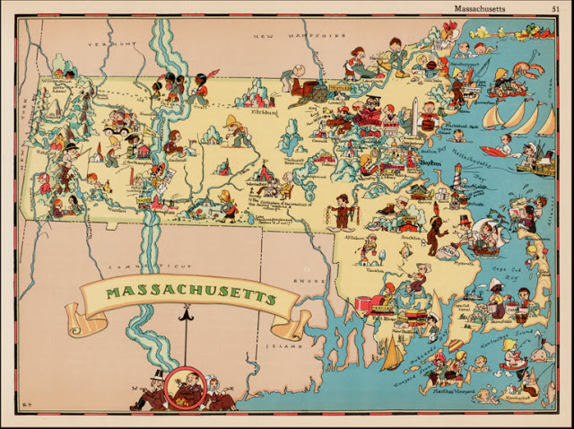
I love maps.  I can stare at them for ages, remembering the places I have been and dreaming of the places I have yet to visit.   And look what I found--vintage maps of the Hawaiian islands by Ruth Taylor White from the 1930s.  Heaven!
Images were long used to enliven maps (think sea monsters in the oceans of 16th century examples), but pictorial maps found a wide audience in the 20th century.  As means of transportation improved, more people could travel to more places, leading to the increased need for maps.  A map could delineate the roads and geography of the place, but it could also be used as an enticement.  Clever and appealing pictures added to a map helped create an image of the place that made it irresistible.  This type of illustrated map is sometimes called a cartograph, or pictograph.
Signature on the Oahu map--Ruth would later drop her married name when signing her work
Enter Ruth Taylor--traveler, illustrator, cartographer. 

Born in 1899, Taylor and her family, like many, headed persistently west in the late 19th century, moving from East Coast to West in the span of about 20 years and finally settling in California. According to the 1920 US Census, Taylor seemed to be settling into a pretty normal life--she was married to Leonard White and living in Phoenix, Arizona.  Leonard was a life insurance salesman.  Two kids followed, and so did divorce.  With limited information, it’s easy to fill in the gaps and imagine a disastrous mismatch of temperaments, but all we know is that Ruth and her children moved to California and she began working as an illustrator.
From Art Deco Blog
Ruth’s artistic training is unclear, but her family proved to be very important in her future work.  Several of her early jobs were linked to her brother, Frank J. Taylor (1894-1972).  Frank was a journalist and writer, served in World War I, and attended Stanford University.  That school connection probably helped Ruth earn one of her early commissions, the cover of the November 1927 The Stanford Illustrated Review.  Her detailed style brings humorous life to the crowd attending a football game.
From the National Parks website
Ruth and her brother moved in an artistic and adventurous circle in the San Francisco area and the siblings shared an interest in the majestic nature found in the country's national parks.  Frank was married to Katherine Ames, who was also an author.  Like Frank, Ames was interested in nature and travel and she wrote books on nearby Yosemite National Park.  Her 1926 Lights and Shadows of Yosemite featured the first published photographs by Ansel Adams.  Frank wrote popular books on the national parks and Ruth provided illustrations for his 'Oh, Ranger!’ A Book About the National Parks (1928) and Grand Canyon Country (1930), both of which went into multiple printings.
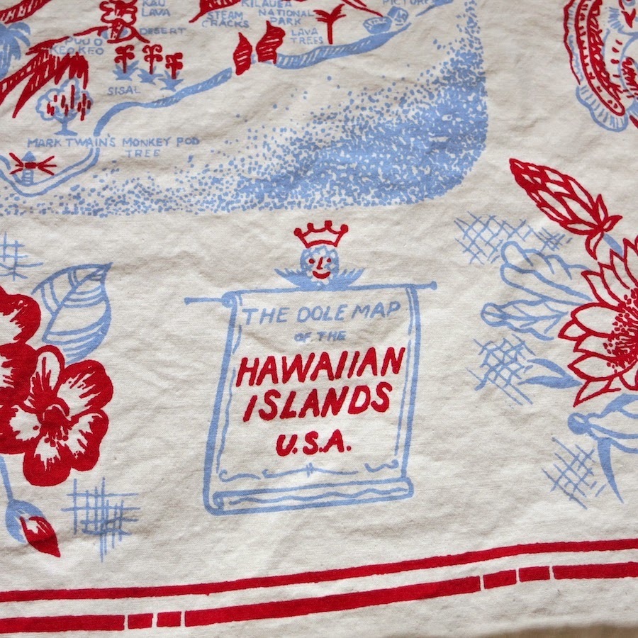
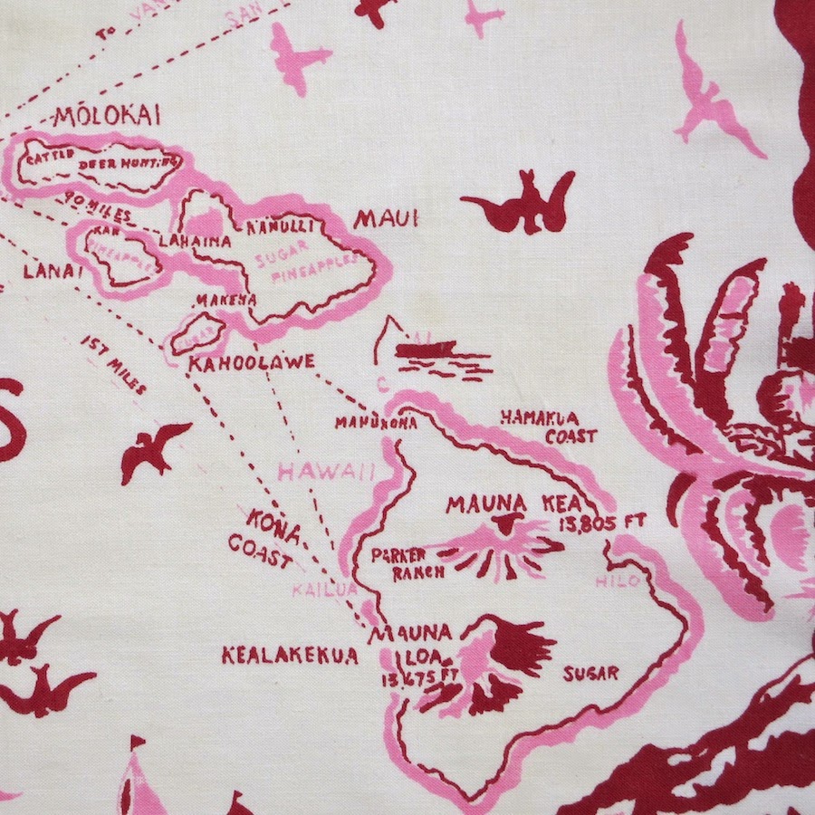
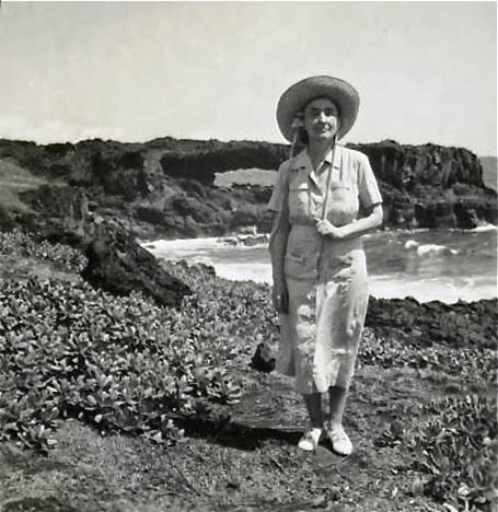
Ruth’s style crystallized in the 1930s, when she was at her busiest and most peripatetic.  In the Spring of 1930, she left the kids at home in California and spent five weeks in Hawaii.  Her trip was likely prompted by a commission from the Hawaii Tourist Bureau to draw the maps of the Hawaiian islands that I just acquired, as printed versions turn up by 1931.  The four largest islands of Kauai, Oahu, Maui and the Big Island and a map of the entire island chain are included in the set, which would have been handed out by the Bureau to visitors.
Massachusetts, from Our USA:  A Gay Geography, 1935.  From Barry Lawrence Ruderman.
These Hawaiian maps may have been the seed for a larger project Ruth undertook, again with her brother Frank.  Our USA:  A Gay Geography, published in 1935, was an atlas filled with whimsical and charming maps of all the states in the union, as well as American territories.  The New York Times said in their review, ‘Any one who remembers his childhood efforts to visualize Kentucky as something more than the green spot on the map, or New York as the pink State, will appreciate this volume. Brilliantly colored pictorial maps of the same order which have been amusing adults for the past decade show the United States and their Territories as active, picturesque entities.’ (NYT, 17 Nov 1935).  This book is very tough to find these days, even in libraries, and sadly is most often found dismembered to sell the maps individually.
This is where I live now--Hagerstown, Maryland, at the top left.  There is indeed an organ factory here.  From Saturated Color on Etsy.
So now you have the background for my sweet maps of Hawaii.  These are likely later reprints from the 1940s of Taylor's original 1930 illustrations, published by the Honolulu Star-Advertiser, and given out by the Tourist Bureau to servicemen.  The nice woman from whom I bought these four maps said that her father got them in Hawaii when he was there during World War II and that they had been rolled up in the original mailing tube ever since.
Taylor’s maps aren’t about geographical exactitude, but rather the people and character of the place--what will lure you there and what you will remember when you have left.   And this is decidedly a rich white folks’ view of the islands--people with the money and leisure time to travel were the intended audience of these maps (discussions of imperialism will have to wait for another post).  Golf courses, yacht clubs and polo grounds are generally noted, but so, too, are heiaus (temples), locations connected to Hawaiian royalty and traditional island activities such as hula, surfing and hukilau (a type of net fishing).  Taylor devised a palatable combination of the familiar and exotic, an ideal paradise for tourists.
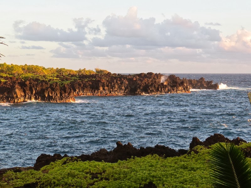
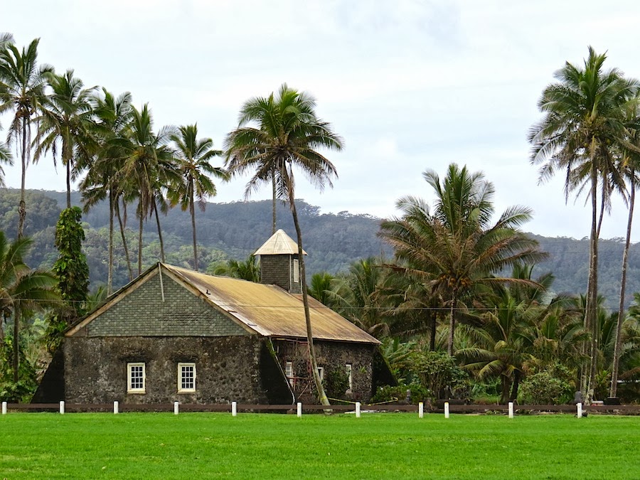
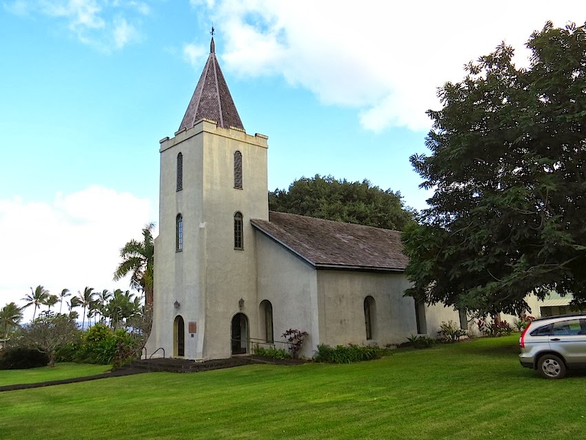
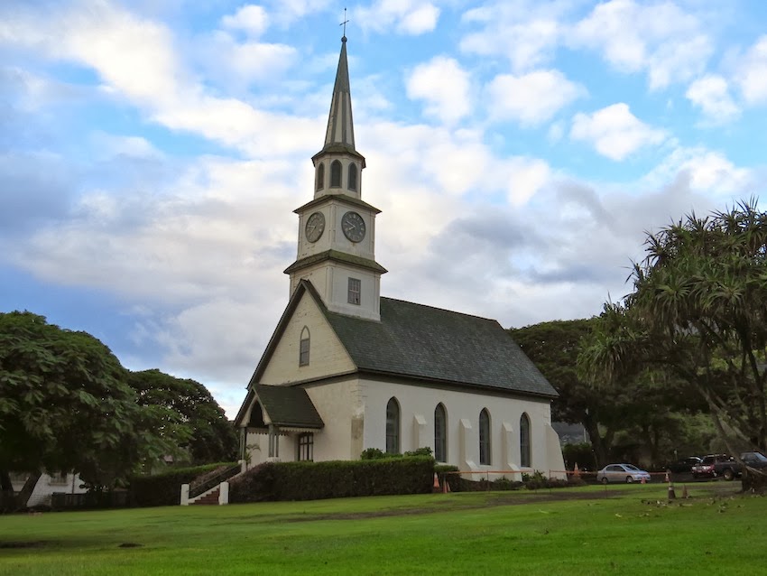
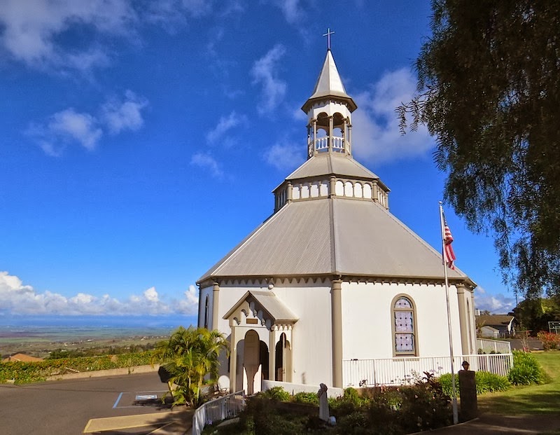
I’m fascinated by these views into Hawaii’s past.  So much has changed (some might say not necessarily for the better), but many places and their attributes are comfortingly the same.  The big banyan tree is still in Lahaina, there are still surfers in Hanalei Bay and coffee still grows in Kona.  It’s interesting to see so many more Hawaiian place names used, the vast pineapple and sugar fields that are no more and the old churches that can still be found dotting the landscape.
Ruth Taylor, Map of Treasure Island, Golden Gate International Exposition, San Francisco, 1939.  From Beinecke Library, Yale.
Ruth Taylor continued to travel. In 1939, at the age of 40, she was in Japan (she did a map of the Philippines that may date from that trip) and as political tensions increased in Asia, she wisely returned home to the San Francisco area.  That year, she rendered a cartograph of Treasure Island, the site of the Golden Gate International Exposition, a copy of which can be found at Beinecke Library at Yale.

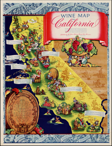
Remarkably, during World War II, Ruth kept up her international wandering.  The end of the war found her in Calcutta, India, and by September 1945 she arrived back in New York, headed to her brother’s home in Los Altos, California.  The wine map of California below is the only work I've found of hers in the post-war years.
Wine map of California by Taylor, late 1940s.  From Barry Lawrence Ruderman
I haven’t been able to find out a lot more about Ruth Taylor in her later years, but would love to learn more about her and her work.  This little bit of research was pretty quickly done and I didn’t have access to all the resources I would have liked (I live in the boonies, remember).   There are many more avenues to be explored!  If you have any corrections, or additional information about her, please do be in touch.


© All text and images are copyright of Jeni Sandberg 2012-2018